
Local Data
Summary Information
-
Climate Facts by County
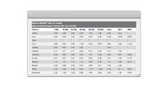
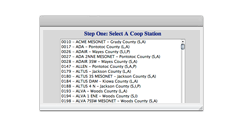
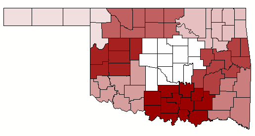
The county links lead to a page that includes data from the National Weather Service Cooperative Observer Program and the Oklahoma Mesonet. Quick climate facts and longer, more detailed climate data can be found for each county. Information concerning temperature, precipitation, humidity, wind, soil, freeze data, extremes and normals can all be found in the individual county pages.
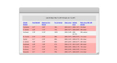
Daily Information
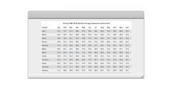
Monthly Information


Copyright © 1994-2024 Board of Regents of the University of Oklahoma. All Rights Reserved.